Methodology: I divided my research into (1) the oil and natural gas wells and (2) coal mining. To find the former, I searched “Oil Natural Gas Wells map” onto Google and identified the link from the EIA as trustworthy. I did notice some resources for proximity to coal mining on this site, but to find a more detailed site I googled “Proximity to Coal Mining map US,” and clicked on
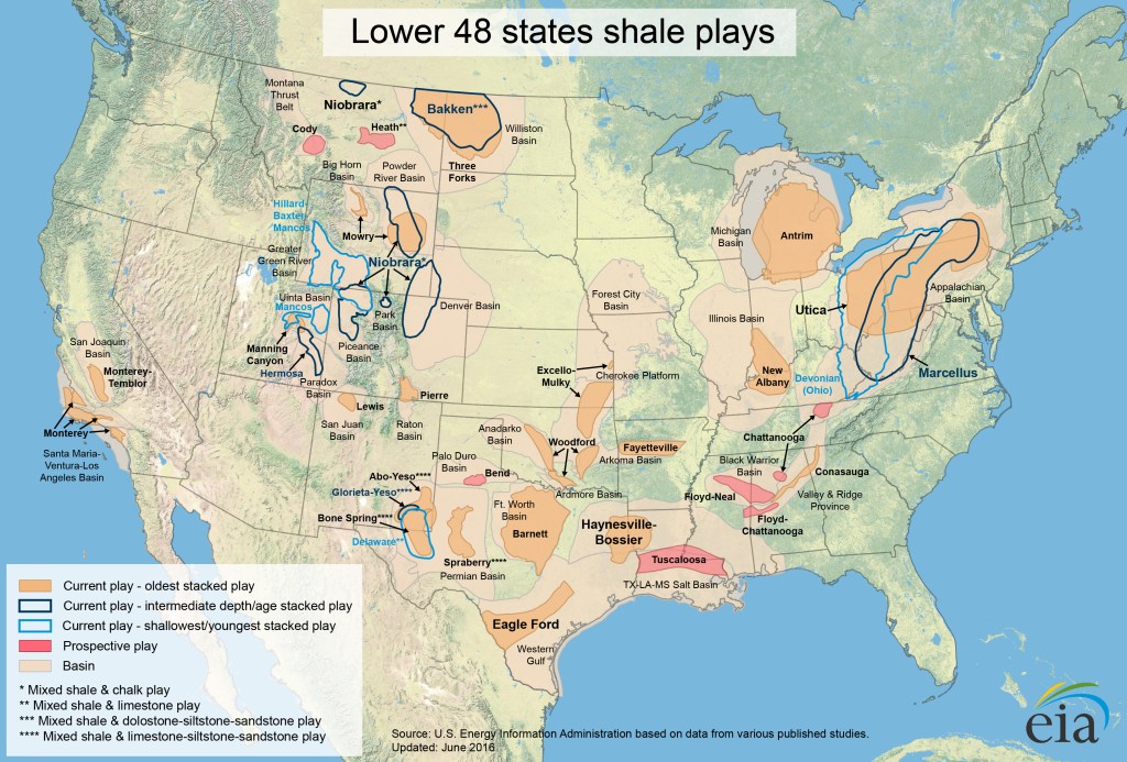
The following maps show the drilling history and oil and gas production of selected low-permeability, continuous-type shale reservoirs. Selected geologic characteristics pertinent to occurrence of producible oil and gas resources are also shown when available.

2. Interactive map of coal resources in the United States
The U.S. Geological Survey’s National Coal Resources Data System comes with an interactive map that provides a huge amount of information on the distribution, thickness, and classification of coal in the United States.
The interactive map contains over 250,000 data points, each typically representing a core sample, drill hole, or driller’s log in a specific location. You can use the “Filter” tool to focus in on specific areas, or on data collected by specific organizations.
