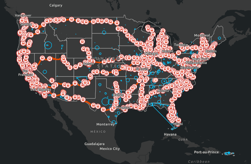
American Public Transportation Association is a nonprofit international organization. Ninety percent of public transportation is a member of this organization. This interactive map allows the user to explore nationwide transportation data, including bus and train stations locations, train routes, and manufacturing companies.
Methodology: This website was found by googling “public transit availability US.” I then clicked on the APTA link “Public Transportation Facts,” which brought me to a webpage with a “Research & Technical Resources” section. I then clicked on the “Industry Footprint” section and I was brought to a page with a “map” section.
2. American Public Transportation Association 2020 Fact Book

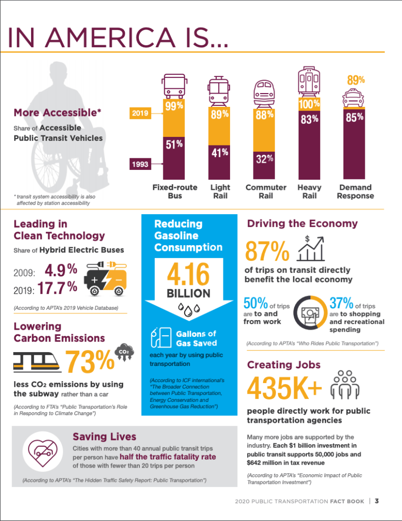
This fact book includes data that the APTA compiled during the 2020 year in the US. This includes an overview of passenger data, service availability, employment, infrastructure, safety, funding, and more.
Methodology: This website was found by googling “public transit availability US.” I then clicked on the APTA link “Public Transportation Facts,” and I then clicked on the “Public Transportation Fact Book” link. This brought me to a page with a link to the 2020 fact book.
