Methodology:
Searching for a map of providers of health care services in the united states using the google search engine on Chrome produced the following relevant results:
ArcGIS U.S. Healthcare Sites
Build interactive maps that explain your data and encourage users to explore. Map your own data and gain perspective by adding the authoritative location-based data included in ArcGIS Online. Use smart mapping to guide your data exploration and visualization.
This map service shows the locations of healthcare facilities (hospitals, medical centers, federally qualified health centers, home health services, and nursing homes) in the United States. The data was provided by the U.S. Department of Health & Human Services and is current as of 2012.
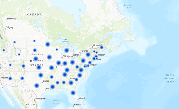
The data is symbolized by facility type:
- Hospital: an institution providing medical and surgical treatment and nursing care for sick or injured people.
- Medical Center: a health care facility staffed and equipped to care for many patients and for a large number of various kinds of diseases and dysfunctions, using sophisticated technology.
- Federally Qualified Health Center: a community-based organization that provides comprehensive primary care and preventative care, including health, oral, and mental health/substance abuse services to persons of all ages, regardless of their ability to pay or health insurance status.
- Home Health Service: health care or supportive care provided in the patient’s home by health care professionals (often referred to as home health care or formal care).
- Nursing Home: provides a type of residential care. They are a place of residence for people who require constant nursing care and have significant deficiencies with activities of daily living.
Other data sources include: Data.gov
Maps – HRSA datadata.hrsa.gov

It lists Listing the various HRSA map tools available for users to customize maps using a variety of data – grants, facility locations, service boundaries, demographics and more.
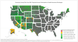
CMS.gov- Centers for Medicare and Medicaid Services—
It contains the 2021 projected health insurance exchange coverage maps
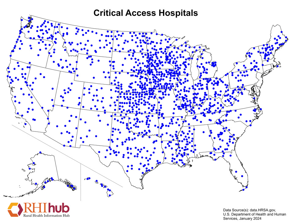
Rural Health Information Hub Maps
Maps describing the rural population, including health insurance coverage, population change, number of healthcare providers in primary care, mental health, or dental health services.
- Demographics
Maps describing the rural population, including health insurance coverage, population change, frontier counties, minority populations, poverty rates by age, median household income, and more. - Health Status
Maps showing health status in rural areas, including life expectancy, disability status, and teen birth rates. - Health Workforce
Maps showing areas that have an inadequate number of healthcare providers in primary care, mental health, or dental health services. - Healthcare Facilities
Maps showing the location of rural hospitals, clinics, and other rural healthcare facilities.
